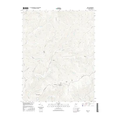
2016 Map of Skelt
USGS Topo · Published 2016About this map
Skelt, Woodzell, and Bernardstown anchor this pocket of the West Virginia highlands where the watersheds of the Holly and Elk rivers diverge. The landscape is defined by its deep drainages and ridges, including the prominent Fork Ridge and Back Fork Mtn. Small settlements and family landmarks are scattered along these heights and valleys, notably the Laurel Fork Cem Allen Cogar Cem and the Lower Point Mountain Community Church Cem. These features, alongside the Fairview Cem and Point Mountain Cem, provide important markers for local genealogy and land-use history. The river system is particularly intricate here, with the Right Fork Holly River meeting a network of runs such as Potato Knob Run and Sawyer Run, while the Buck Fork Elk River flows through the southern reaches near Potato Knob.
Find a feature on this map
67 named features on this map. Tap any name to fly to it.
Don’t see what you’re looking for? This feature index may not catch every label — zoom into the map to look around manually.
Map Details
Editions of this 2016 Skelt Map
This is the sole edition of this map. No revisions or reprints were ever made.
Other maps of this area

1891 · Huntersville
USGS Topo · 1:125,000

1893 · Buckhannon
USGS Topo · 1:125,000

1894 · Huntersville
USGS Topo · 1:125,000

1896 · Buckhannon
USGS Topo · 1:125,000

1897 · Buckhannon
USGS Topo · 1:125,000

1913 · Hacker Valley
USGS Topo · 1:48,000

1913 · Pickens
USGS Topo · 1:48,000

1915 · Webster Springs
USGS Topo · 1:48,000

1915 · Hacker Valley
USGS Topo · 1:62,500

1915 · Pickens
USGS Topo · 1:62,500