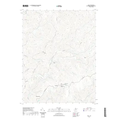
2019 Map of Skelt
USGS Topo · Published 2019About this map
Bernardstown and the small settlement of Skelt anchor this portion of Webster County, situated within a landscape defined by the drainage divide between the Back Fork Elk River and the Right Fork Holly River. The terrain is characterized by long, high ridges such as Point Mtn and Fork Ridge, which dictate the placement of local thoroughfares like Point Mountain Rd. Small family and community cemeteries are scattered throughout the hills, including the Allen Cogar Cem and Potato Knob Cem, providing significant points of interest for genealogical research in this rural Appalachian environment.
Find a feature on this map
63 named features on this map. Tap any name to fly to it.
Don’t see what you’re looking for? This feature index may not catch every label — zoom into the map to look around manually.
Map Details
Editions of this 2019 Skelt Map
This is the sole edition of this map. No revisions or reprints were ever made.
Other maps of this area

1891 · Huntersville
USGS Topo · 1:125,000

1893 · Buckhannon
USGS Topo · 1:125,000

1894 · Huntersville
USGS Topo · 1:125,000

1896 · Buckhannon
USGS Topo · 1:125,000

1897 · Buckhannon
USGS Topo · 1:125,000

1913 · Hacker Valley
USGS Topo · 1:48,000

1913 · Pickens
USGS Topo · 1:48,000

1915 · Webster Springs
USGS Topo · 1:48,000

1915 · Hacker Valley
USGS Topo · 1:62,500

1915 · Pickens
USGS Topo · 1:62,500