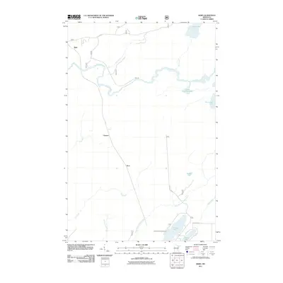
2011 Map of Skibo
USGS Topo · Published 2011About this map
The Saint Louis River snakes across this northern Minnesota landscape, defining the character of a region where water and timber historical ties are evident. Near the northern edge, the settlement of Skibo and the nearby Skibo Mill reflect the area's industrial past, while small clusters like Clappers and Reno anchor the sparse interior. The map reveals a transition toward recreational land use in the early 21st century, particularly around the southern water bodies where the Cadotte Lake Campground sits along the shores of Cadotte Lake.
Find a feature on this map
22 named features on this map. Tap any name to fly to it.
Don’t see what you’re looking for? This feature index may not catch every label — zoom into the map to look around manually.
Map Details
Editions of this 2011 Skibo Map
This is the sole edition of this map. No revisions or reprints were ever made.
Other maps of this area

1949 · Allen
USGS Topo · 1:24,000

1950 · Allen
USGS Topo · 1:24,000

1951 · Babbitt SW
USGS Topo · 1:24,000

1952 · Babbitt SE
USGS Topo · 1:24,000

1954 · Two Harbors
USGS Topo · 1:250,000

1954 · Hibbing
USGS Topo · 1:250,000

1957 · Two Harbors
USGS Topo · 1:250,000

1957 · Hibbing
USGS Topo · 1:250,000

1957 · Brimson
USGS Topo · 1:62,500

1957 · Markham
USGS Topo · 1:62,500