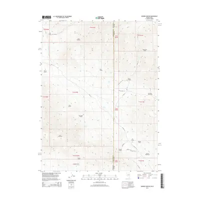
2014 Map of Skinner Canyon
USGS Topo · Published 2014About this map
The Kern Mountains and the South Mountains dominate this high-desert topography along the border of White Pine County and Juab County. This 2014 survey reveals a landscape defined by dramatic elevation changes and a network of named springs that have likely served as vital water sources for generations. From Indian Spring to Upper Sulphur Spring, these water points are the anchors of the terrain. The transition between Nevada and Utah is marked by the rugged descent into Pleasant Valley and the Deep Creek Range to the east. A primitive road network, including Tippet Rd and Wish Bone Rd, provides access to deep drainages like Essex Canyon and Skinner Canyon. This map is particularly valuable for those studying the physical geography and hydrology of the Great Basin borderlands.
Find a feature on this map
46 named features on this map. Tap any name to fly to it.
Don’t see what you’re looking for? This feature index may not catch every label — zoom into the map to look around manually.
Map Details
Editions of this 2014 Skinner Canyon Map
This is the sole edition of this map. No revisions or reprints were ever made.
Other maps of this area

1908 · Fish Springs
USGS Topo · 1:250,000

1910 · Fish Springs
USGS Topo · 1:250,000

1953 · Delta
USGS Topo · 1:250,000

1956 · Ely
USGS Topo · 1:250,000

1958 · Delta
USGS Topo · 1:250,000

1959 · Ely
USGS Topo · 1:250,000

1961 · Trout Creek
USGS Topo · 1:62,500

1962 · Delta
USGS Topo · 1:250,000

1963 · Ely
USGS Topo · 1:250,000
1972 · Ibapah Peak
USGS Topo · 1:24,000