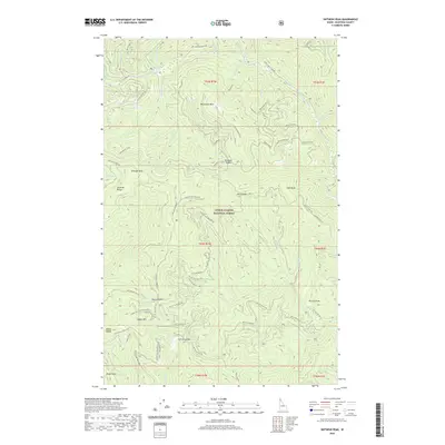
2020 Map of Skitwish Peak
USGS Topo · Published 2020About this map
Coeur d'Alene National Forest defines this high-elevation Idaho landscape, dominated by the drainage of the Little North Fork Coeur d'Alene River. The topography is characterized by a series of prominent peaks and connecting ridges, including Skitwish Peak and Monument Mtn, which serve as anchors for a complex network of forest development roads and specialized trails. The mapping of 4th Of July Pass Ohv and Skitwish Ridge Atv reflect the area's modern role in motorized recreation and forest management. Key transit points such as Skookum Saddle, Marie Saddle, and John Saddle illustrate how the geography dictates movement between the steep canyons of Deception Cr and Stoney Cr. This 2020 edition provides a highly precise look at the contemporary infrastructure of the Idaho panhandle's backcountry, from the heights of John Peak to the deep draws of the river system.
Find a feature on this map
65 named features on this map. Tap any name to fly to it.
Don’t see what you’re looking for? This feature index may not catch every label — zoom into the map to look around manually.
Map Details
Editions of this 2020 Skitwish Peak Map
This is the sole edition of this map. No revisions or reprints were ever made.
Other maps of this area

1903 · Rathdrum
USGS Topo · 1:125,000

1909 · Cataldo
USGS Topo · 1:125,000

1911 · Cataldo
USGS Topo · 1:125,000

1955 · Spokane
USGS Topo · 1:250,000

1957 · Kingston
USGS Topo · 1:62,500

1957 · Lane
USGS Topo · 1:62,500

1958 · Spokane
USGS Topo · 1:250,000

1961 · Lakeview
USGS Topo · 1:62,500

1961 · Athol
USGS Topo · 1:62,500
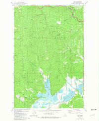
1981 · Lane
USGS Topo · 1:24,000