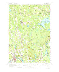
1955 Map of Skowhegan
USGS Topo · Published 1973About this map
The Kennebec River flows through the southwest corner of this Somerset County landscape, where the town of Skowhegan serves as a central hub for transportation and community life. In the mid-1950s, the area's economy is reflected in the numerous mills and specialized educational sites, from Waltons Mill and Malbons Mills to the Somerset Academy in Athens. The mapping of small rural schools like Whittier Sch and Revere Sch alongside many family-named cemeteries, such as the Richards Cem and Kinsman Cem, provides a detailed view of the era's settlement patterns. Recreation and early modern leisure are evident in the presence of Great Moose Lake and specialized summer camps like Camp Modin for Girls and Camp Modin for Boys near Lake George. The Maine Central railroad and a local Airstrip highlight the evolving transport network of mid-century central Maine.
Find a feature on this map
132 named features on this map. Tap any name to fly to it.
Don’t see what you’re looking for? This feature index may not catch every label — zoom into the map to look around manually.
Map Details
Editions of this 1955 Skowhegan Map
4 editions found

Other maps of this area

1892 · Waterville
USGS Topo · 1:62,500

1894 · Norridgewock
USGS Topo · 1:62,500

1898 · Norridgewock
USGS Topo · 1:62,500

1903 · Bingham
USGS Topo · 1:62,500

1904 · Anson
USGS Topo · 1:62,500

1905 · Bingham
USGS Topo · 1:62,500

1913 · Skowhegan
USGS Topo · 1:62,500

1926 · Burnham
USGS Topo · 1:62,500

1930 · Pittsfield
USGS Topo · 1:48,000

1932 · Pittsfield
USGS Topo · 1:62,500