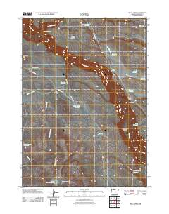
2011 Map of Skull Creek
USGS Topo · Published 2011About this map
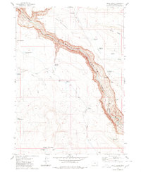
The Owyhee River carves a deep path through this section of Malheur County, defining a landscape dominated by water management and high-desert terrain. By 2011, the region's ranching and livestock heritage is clearly visible through an extensive network of named reservoirs, including Lambing Camp Reservoir, Eiguren Reservoir, and the Dead Horse Butte Reservoir. These artificial water sources, paired with features like Scotts Ditch, illustrate the vital infrastructure required to support life and industry in this arid corner of eastern Oregon.
Find a feature on this map
33 named features on this map. Tap any name to fly to it.
Don’t see what you’re looking for? This feature index may not catch every label — zoom into the map to look around manually.
Map Details
Editions of this 2011 Skull Creek Map
This is the sole edition of this map. No revisions or reprints were ever made.
Other maps of this area

1955 · Jordan Valley
USGS Topo · 1:250,000

1957 · Jordan Valley
USGS Topo · 1:250,000

1958 · Jordan Valley
USGS Topo · 1:250,000
1969 · Little Grassy Mountain
USGS Topo · 1:24,000
1969 · Juniper Ridge
USGS Topo · 1:24,000
1969 · Dry Creek Rim
USGS Topo · 1:24,000
1980 · Skull Creek
USGS Topo · 1:24,000

1980 · Three Forks
USGS Topo · 1:24,000
1980 · Caviatta Ridge
USGS Topo · 1:24,000
1980 · Squaw Flat
USGS Topo · 1:24,000