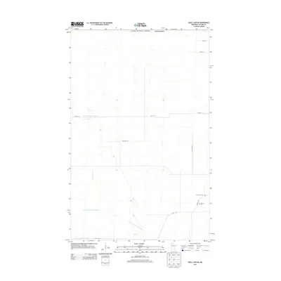
2013 Map of Skull Lake NE
USGS Topo · Published 2013About this map
Hewett Family Cem and N Prairie Cem stand as quiet markers of rural heritage in this northern corner of Kittson County, just south of the Canadian border. The landscape is defined by an extensive water management network, where engineered waterways like State Ditch Number Eightyfour and State Ditch Number Seventytwo crisscross the flat terrain. These drainage projects, along with State Ditch Number Eightyfive, reflect the century-long effort to transform these low-lying wetlands into productive agricultural territory. Natural drainage persists through the N Br Two Rivers, which meanders through a grid of township roads. The map reveals the precise layout of local infrastructure, from Twp Hwy T-316 to Twp Hwy T-5, which continue to facilitate access to the remote farmsteads and cemeteries of this frontier region.
Find a feature on this map
14 named features on this map. Tap any name to fly to it.
Don’t see what you’re looking for? This feature index may not catch every label — zoom into the map to look around manually.
Map Details
Editions of this 2013 Skull Lake NE Map
This is the sole edition of this map. No revisions or reprints were ever made.
Other maps of this area

1918 · Hemmington
USGS Topo · 1:62,500

1930 · Juneberry
USGS Topo · 1:31,680

1932 · Juneberry
USGS Topo · 1:62,500

1952 · Thief River Falls
USGS Topo · 1:250,000

1956 · Thief River Falls
USGS Topo · 1:250,000

1957 · Thief River Falls
USGS Topo · 1:250,000

1966 · Skull Lake
USGS Topo · 1:24,000

1966 · Caribou
USGS Topo · 1:24,000

1966 · Skull Lake NE
USGS Topo · 1:24,000

1966 · Skull Lake SE
USGS Topo · 1:24,000