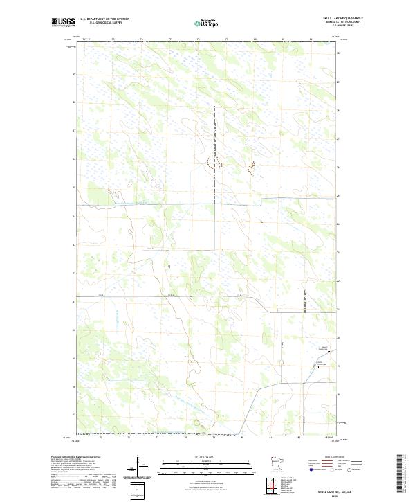
2022 Map of Skull Lake NE
USGS Topo · Published 2022About this map
N Br Two Rivers meanders through this portion of Kittson County, where an extensive network of water management channels defines the low-lying terrain. Features like State Ditch Number Eightyfour, State Ditch Number Seventytwo, and State Ditch Number Eightyfive illustrate the engineered drainage systems required for agriculture in this northern Minnesota landscape. Local history is anchored by small burial grounds along the eastern edge of the survey, including the North Prairie Cem and the Hewett Family Cem, which sit near the intersection of Co Rd 25 and a marked Closed Rd. This grid-heavy rural environment is primarily accessed by a system of county and field roads, such as Field Rd and Co Rd 4, which cut across the various township and range boundaries.
Find a feature on this map
17 named features on this map. Tap any name to fly to it.
Don’t see what you’re looking for? This feature index may not catch every label — zoom into the map to look around manually.
Map Details
Editions of this 2022 Skull Lake NE Map
This is the sole edition of this map. No revisions or reprints were ever made.
Other maps of this area

1918 · Hemmington
USGS Topo · 1:62,500

1930 · Juneberry
USGS Topo · 1:31,680

1932 · Juneberry
USGS Topo · 1:62,500

1952 · Thief River Falls
USGS Topo · 1:250,000

1956 · Thief River Falls
USGS Topo · 1:250,000

1957 · Thief River Falls
USGS Topo · 1:250,000

1966 · Skull Lake
USGS Topo · 1:24,000

1966 · Caribou
USGS Topo · 1:24,000

1966 · Skull Lake NE
USGS Topo · 1:24,000

1966 · Skull Lake SE
USGS Topo · 1:24,000