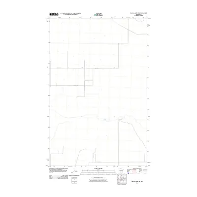
2010 Map of Skull Lake SE
USGS Topo · Published 2010About this map
Kittson County land in northwestern Minnesota is defined by a rigorous grid of section lines and township roads as it appeared in 2010. The landscape is dominated by agricultural parcels and drainage patterns, with movement facilitated by local thoroughfares such as County Hwy-60 and various township routes. This U.S. Department of the Interior survey illustrates the highly structured rural infrastructure of the region, where roads like Twp Hwy T-9, Twp Hwy T-36, and Twp Hwy T-10 delineate property boundaries and farm access. The sparse distribution of buildings and specialized structures highlights the remote nature of this prairie borderland, showing how the mid-century road system continued to serve the farming community into the new millennium.
Find a feature on this map
7 named features on this map. Tap any name to fly to it.
Don’t see what you’re looking for? This feature index may not catch every label — zoom into the map to look around manually.
Map Details
Editions of this 2010 Skull Lake SE Map
This is the sole edition of this map. No revisions or reprints were ever made.
Other maps of this area

1918 · Hemmington
USGS Topo · 1:62,500

1919 · Pelan
USGS Topo · 1:62,500

1930 · Juneberry
USGS Topo · 1:31,680

1932 · Juneberry
USGS Topo · 1:62,500

1952 · Thief River Falls
USGS Topo · 1:250,000

1956 · Thief River Falls
USGS Topo · 1:250,000

1956 · Karlstad
USGS Topo · 1:62,500

1957 · Thief River Falls
USGS Topo · 1:250,000

1957 · Pelan
USGS Topo · 1:62,500

1966 · Skull Lake
USGS Topo · 1:24,000