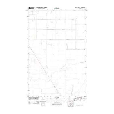
2010 Map of Skull Lake SW
USGS Topo · Published 2010About this map
North Branch Two Rivers and Middle Branch Two Rivers define the hydrology of this rural Kittson County landscape, meandering across a grid of section-line roads. The area is characterized by an expansive drainage network, reflecting the agricultural development common in the northwestern corner of the state during the early 21st century. The local transportation infrastructure is dominated by a systematic web of township and county highways, such as County Hwy-4 and 360th Ave. These routes provide essential connectivity across the flat terrain, where land use is primarily focused on the fields and watercourses that shape the regional economy and layout. This survey from the U.S. Geological Survey captures the steady, quiet character of the plains before any significant modern shifts in land management or rural population density.
Find a feature on this map
23 named features on this map. Tap any name to fly to it.
Don’t see what you’re looking for? This feature index may not catch every label — zoom into the map to look around manually.
Map Details
Editions of this 2010 Skull Lake SW Map
This is the sole edition of this map. No revisions or reprints were ever made.
Other maps of this area

1918 · Hemmington
USGS Topo · 1:62,500

1939 · Kennedy
USGS Topo · 1:62,500

1941 · Kennedy
USGS Topo · 1:62,500

1941 · Hallock
USGS Topo · 1:62,500

1952 · Thief River Falls
USGS Topo · 1:250,000

1956 · Thief River Falls
USGS Topo · 1:250,000

1956 · Karlstad
USGS Topo · 1:62,500

1957 · Thief River Falls
USGS Topo · 1:250,000

1966 · Skull Lake
USGS Topo · 1:24,000

1966 · Skull Lake NE
USGS Topo · 1:24,000