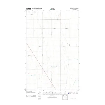
2013 Map of Skull Lake SW
USGS Topo · Published 2013About this map
Middle Br Two Rivers winds across this rural Kittson County landscape, defining the hydrology of an area where natural drainage has been heavily modified for agriculture. The presence of State Ditch Number Forty Eight in the southeastern corner illustrates the extensive water management systems required to make this prairie region productive. This 2013 survey shows a strictly organized grid of township roads, including 360th Ave and numerous numbered routes like TWP HWY T-70 and TWP HWY T-38. The primary transportation artery is Mn-175, which intersects the grid near the center of the sheet. Apart from these transportation and drainage networks, the map depicts a sparse, open territory typical of the northern Red River Valley periphery, where settlement is focused on large-scale farming and infrastructure rather than dense town centers.
Find a feature on this map
24 named features on this map. Tap any name to fly to it.
Don’t see what you’re looking for? This feature index may not catch every label — zoom into the map to look around manually.
Map Details
Editions of this 2013 Skull Lake SW Map
This is the sole edition of this map. No revisions or reprints were ever made.
Other maps of this area

1918 · Hemmington
USGS Topo · 1:62,500

1939 · Kennedy
USGS Topo · 1:62,500

1941 · Kennedy
USGS Topo · 1:62,500

1941 · Hallock
USGS Topo · 1:62,500

1952 · Thief River Falls
USGS Topo · 1:250,000

1956 · Thief River Falls
USGS Topo · 1:250,000

1956 · Karlstad
USGS Topo · 1:62,500

1957 · Thief River Falls
USGS Topo · 1:250,000

1966 · Skull Lake
USGS Topo · 1:24,000

1966 · Skull Lake NE
USGS Topo · 1:24,000