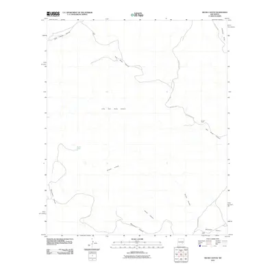
2010 Map of Skunk Canyon
USGS Topo · Published 2010About this map
Corn Ranch and Johnson Ranch sit within a landscape of deep drainage systems and high desert terrain in this 2010 study of Chaves County. The area is defined by the winding paths of Skunk Canyon and Twin Butte Canyon, which serve as the primary topographic features cutting through the region. Transportation in this ranching country is tied to the canyon floors and ridges, with Monument Canyon Rd and Johnson Draw Rd providing access to remote outposts like Buck Camp. The mapping of these ephemeral water systems, including Antelope Draw and the isolated Pond Lake, illustrates the vital importance of water management for cattle operations in the arid New Mexico interior. The distribution of these ranch sites suggests a continuation of traditional land use patterns, where settlements are strategically positioned relative to the natural draws and canyon breaks.
Find a feature on this map
14 named features on this map. Tap any name to fly to it.
Don’t see what you’re looking for? This feature index may not catch every label — zoom into the map to look around manually.
Map Details
Editions of this 2010 Skunk Canyon Map
This is the sole edition of this map. No revisions or reprints were ever made.
Other maps of this area

1955 · Roswell
USGS Topo · 1:250,000

1956 · Diamond A Ranch
USGS Topo · 1:24,000

1958 · Roswell
USGS Topo · 1:250,000

1959 · Diamond A Ranch
USGS Topo · 1:24,000

1961 · Flying H
USGS Topo · 1:62,500

1961 · Indian Bluff
USGS Topo · 1:62,500

1961 · Tinnie
USGS Topo · 1:62,500

1962 · Roswell
USGS Topo · 1:250,000

1962 · Horseshoe Bend
USGS Topo · 1:62,500

1979 · Roswell
USGS Topo · 1:100,000