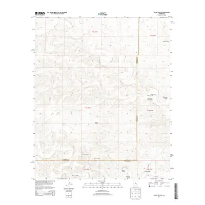
2013 Map of Skunk Canyon
USGS Topo · Published 2013About this map
The Lincoln and Chaves county line bisects this high-desert landscape, where ranching outposts and rugged topography define the borderlands of southeastern New Mexico. Land usage is marked by isolated sites such as Corn Ranch in the north and the Johnson Ranch to the east, illustrating the sparse settlement pattern common in this arid region. The terrain is deeply incised by several prominent drainages, including the eponymous Skunk Canyon and the winding Brushy Canyon. Water sources are few and critical, indicated by South Lake and Pond Lake, which likely serve as vital stock tanks for local cattle operations. A network of unimproved roads like Monument Canyon Rd and Johnson Draw Rd provides the primary access through the steep-walled Monument Canyon and toward high points like Little Twin Butte Canyon. This survey provides a clear view of the ranching infrastructure and natural landmarks at the county boundary.
Find a feature on this map
21 named features on this map. Tap any name to fly to it.
Don’t see what you’re looking for? This feature index may not catch every label — zoom into the map to look around manually.
Map Details
Editions of this 2013 Skunk Canyon Map
This is the sole edition of this map. No revisions or reprints were ever made.
Other maps of this area

1955 · Roswell
USGS Topo · 1:250,000

1956 · Diamond A Ranch
USGS Topo · 1:24,000

1958 · Roswell
USGS Topo · 1:250,000

1959 · Diamond A Ranch
USGS Topo · 1:24,000

1961 · Flying H
USGS Topo · 1:62,500

1961 · Indian Bluff
USGS Topo · 1:62,500

1961 · Tinnie
USGS Topo · 1:62,500

1962 · Roswell
USGS Topo · 1:250,000

1962 · Horseshoe Bend
USGS Topo · 1:62,500

1979 · Roswell
USGS Topo · 1:100,000