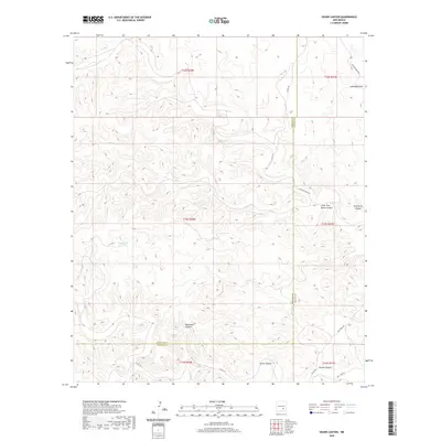
2020 Map of Skunk Canyon
USGS Topo · Published 2020About this map
Pond Lake and a series of deeply etched drainage systems define this landscape along the border of Lincoln and Chaves Counties. The map reveals a complex network of topographical features, from the sharp relief of Little Twin Butte Canyon and Twin Butte Canyon in the east to the long reach of Monument Canyon further south. These arid corridors, including Skunk Canyon and Antelope Draw, illustrate the natural drainage patterns that have shaped the high plains of New Mexico. Human presence is marked primarily by ranching and access roads such as Salt Lake Rd and Buchanan Rd, which navigate the intervals between the draws. This survey captures the remote character of the region as it appeared in the early 21st century, showing how the land is segmented by the Public Land Survey System across multiple townships and ranges.
Find a feature on this map
20 named features on this map. Tap any name to fly to it.
Don’t see what you’re looking for? This feature index may not catch every label — zoom into the map to look around manually.
Map Details
Editions of this 2020 Skunk Canyon Map
This is the sole edition of this map. No revisions or reprints were ever made.
Other maps of this area

1955 · Roswell
USGS Topo · 1:250,000

1956 · Diamond A Ranch
USGS Topo · 1:24,000

1958 · Roswell
USGS Topo · 1:250,000

1959 · Diamond A Ranch
USGS Topo · 1:24,000

1961 · Flying H
USGS Topo · 1:62,500

1961 · Indian Bluff
USGS Topo · 1:62,500

1961 · Tinnie
USGS Topo · 1:62,500

1962 · Roswell
USGS Topo · 1:250,000

1962 · Horseshoe Bend
USGS Topo · 1:62,500

1979 · Roswell
USGS Topo · 1:100,000