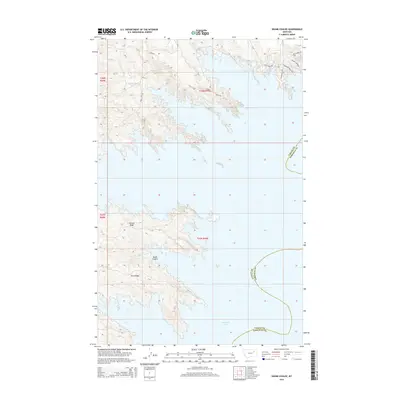
2014 Map of Skunk Coulee
USGS Topo · Published 2014About this map
Fort Peck Lake dominates the southern half of this landscape, its intricate shoreline carving deep into the rugged breaks of Valley and Garfield counties. The irregular fingers of the reservoir wrap around prominent high ground including Second Ridge and Third Ridge, illustrating the complex topography of the Missouri River country. To the north, the terrain is defined by dry drainage features like Skunk Coulee and Mud Cr. A sparse network of local access routes, such as Duck Creek Rd and the curiously named Millionair Mile, serve this isolated ranching and recreation area. The presence of Poverty Ridge Rd and Stenbroke Ridge Rd near the N Fork Duck Cr further highlights the local character and history of land use in this part of northeastern Montana.
Find a feature on this map
19 named features on this map. Tap any name to fly to it.
Don’t see what you’re looking for? This feature index may not catch every label — zoom into the map to look around manually.
Map Details
Editions of this 2014 Skunk Coulee Map
This is the sole edition of this map. No revisions or reprints were ever made.
Other maps of this area

1914 · Nashua
USGS Topo · 1:62,500

1916 · Nashua
USGS Topo · 1:62,500

1943 · Glasgow
USGS Topo · 1:125,000

1954 · Jordan
USGS Topo · 1:250,000

1954 · Glasgow
USGS Topo · 1:250,000

1956 · Jordan
USGS Topo · 1:250,000

1957 · Glasgow
USGS Topo · 1:250,000

1958 · Glasgow
USGS Topo · 1:250,000

1958 · Jordan
USGS Topo · 1:250,000

1958 · Lewis Reservoir
USGS Topo · 1:24,000