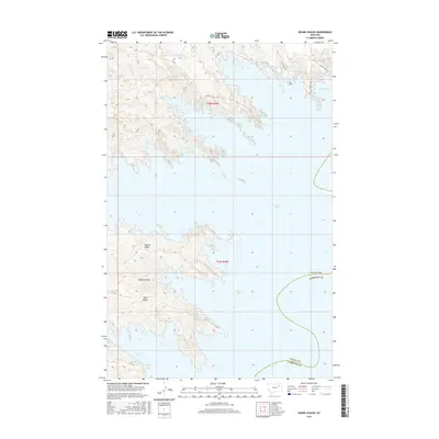
2017 Map of Skunk Coulee
USGS Topo · Published 2017About this map
Fort Peck Lake dominates this landscape along the border of Valley and Garfield Counties, where the reservoir's irregular shoreline creates a complex series of inlets and peninsulas. The terrain is characterized by a sequence of dramatic landforms, including Second Ridge and Third Ridge, which flank the namesake Skunk Coulee. These features illustrate the deeply eroded topography typical of the Missouri River breaks region. Transportation in this area is limited to rural routes like Rd 108 and Rd 523, alongside local tracks such as the curiously named Millionaire Mile and Poverty Ridge Rd near Catfish Bay. Small watercourses like Mud Cr and N Fork Duck Cr drain the high ground, providing a glimpse into the natural drainage patterns that existed before the massive dam projects altered the valley's hydrology.
Find a feature on this map
17 named features on this map. Tap any name to fly to it.
Don’t see what you’re looking for? This feature index may not catch every label — zoom into the map to look around manually.
Map Details
Editions of this 2017 Skunk Coulee Map
This is the sole edition of this map. No revisions or reprints were ever made.
Other maps of this area

1914 · Nashua
USGS Topo · 1:62,500

1916 · Nashua
USGS Topo · 1:62,500

1943 · Glasgow
USGS Topo · 1:125,000

1954 · Jordan
USGS Topo · 1:250,000

1954 · Glasgow
USGS Topo · 1:250,000

1956 · Jordan
USGS Topo · 1:250,000

1957 · Glasgow
USGS Topo · 1:250,000

1958 · Glasgow
USGS Topo · 1:250,000

1958 · Jordan
USGS Topo · 1:250,000

1958 · Lewis Reservoir
USGS Topo · 1:24,000