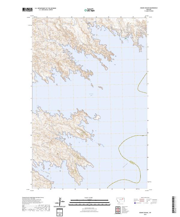
2024 Map of Skunk Coulee
USGS Topo · Published 2024About this map
Fort Peck Lake dominates this Montana landscape, where the waters of the Missouri River meet the complex topography of the Charles M Russell National Wildlife Refuge. The map details the transition from the high, arid breaks of Second Ridge and Third Ridge down to the water's edge. This region, straddling the border of Garfield and Valley counties, reflects a rugged geography where deep incisions like Skunk Coulee and Third Coulee define the drainage patterns leading toward the Missouri. Human presence is concentrated along a few named routes, including the curiously named Millionaire Mile and Poverty Ridge Rd, which suggest the area's local history and ranching heritage. The north is characterized by ephemeral drainages such as Mud Creek and the North Fork Duck Creek, which cut through the high plains before descending into the reservoir system.
Find a feature on this map
22 named features on this map. Tap any name to fly to it.
Don’t see what you’re looking for? This feature index may not catch every label — zoom into the map to look around manually.
Map Details
Editions of this 2024 Skunk Coulee Map
This is the sole edition of this map. No revisions or reprints were ever made.
Other maps of this area

1914 · Nashua
USGS Topo · 1:62,500

1916 · Nashua
USGS Topo · 1:62,500

1943 · Glasgow
USGS Topo · 1:125,000

1954 · Jordan
USGS Topo · 1:250,000

1954 · Glasgow
USGS Topo · 1:250,000

1956 · Jordan
USGS Topo · 1:250,000

1957 · Glasgow
USGS Topo · 1:250,000

1958 · Glasgow
USGS Topo · 1:250,000

1958 · Jordan
USGS Topo · 1:250,000

1958 · Lewis Reservoir
USGS Topo · 1:24,000