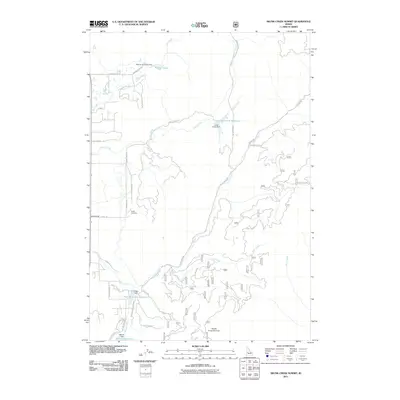
2011 Map of Skunk Creek Summit
USGS Topo · Published 2011About this map
Alpha Grange and the nearby Alpha Cemetery mark the agricultural and social centers of this Valley County landscape. The area is defined by a network of water management features, including the Warren Diversion Dam and several reservoirs like Corral Creek Reservoir and Herrick Reservoir. These water bodies are fed by numerous mountain streams such as Big Creek, Little Horsethief Creek, and Skunk Creek, which flow through the high-elevation terrain near Skunk Creek Summit. The map shows a complex system of forest and local roads, including Gold Dust Rd, W Prospectors Dr, and Ole Ranch Rd, which suggest a history of mining and ranching. The presence of multiple dams, such as Pitkin Dam and Corral Creek Dam, highlights the essential role of water control in sustaining the local economy and environment in this part of Idaho.
Find a feature on this map
39 named features on this map. Tap any name to fly to it.
Don’t see what you’re looking for? This feature index may not catch every label — zoom into the map to look around manually.
Map Details
Editions of this 2011 Skunk Creek Summit Map
This is the sole edition of this map. No revisions or reprints were ever made.
Other maps of this area

1894 · Squaw Creek
USGS Topo · 1:125,000

1909 · Garden Valley
USGS Topo · 1:125,000

1911 · Meadows
USGS Topo · 1:125,000

1953 · Smiths Ferry
USGS Topo · 1:62,500

1953 · Boiling Springs
USGS Topo · 1:62,500

1954 · Gold Fork
USGS Topo · 1:62,500

1954 · Cascade
USGS Topo · 1:62,500

1955 · Baker
USGS Topo · 1:250,000

1957 · Challis
USGS Topo · 1:250,000

1959 · Baker
USGS Topo · 1:250,000