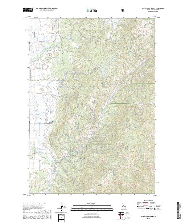
2024 Map of Skunk Creek Summit
USGS Topo · Published 2024About this map
Alpha and its surroundings in the Long Valley region are documented in this contemporary survey, showing the interface between agricultural settlement and the Boise National Forest. The map detail follows the Payette River Scenic Byway as it traverses the western edge of the quadrangle, serving the local community and providing access to the North Fork Range. Genealogists and local historians can locate the Alpha Cem situated near Alpha Ln, while the presence of roads like Gold Dust Rd, Miners Ct, and W Prospectors Dr allude to the area's legacy of resource extraction.
Find a feature on this map
55 named features on this map. Tap any name to fly to it.
Don’t see what you’re looking for? This feature index may not catch every label — zoom into the map to look around manually.
Map Details
Editions of this 2024 Skunk Creek Summit Map
This is the sole edition of this map. No revisions or reprints were ever made.
Other maps of this area

1894 · Squaw Creek
USGS Topo · 1:125,000

1909 · Garden Valley
USGS Topo · 1:125,000

1911 · Meadows
USGS Topo · 1:125,000

1953 · Smiths Ferry
USGS Topo · 1:62,500

1953 · Boiling Springs
USGS Topo · 1:62,500

1954 · Gold Fork
USGS Topo · 1:62,500

1954 · Cascade
USGS Topo · 1:62,500

1955 · Baker
USGS Topo · 1:250,000

1957 · Challis
USGS Topo · 1:250,000

1959 · Baker
USGS Topo · 1:250,000