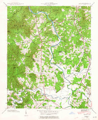
1942 Map of Skyland
USGS Topo · Published 1965About this map
The French Broad River and Mills River converge in this 1942 survey, defining a landscape of agricultural valleys and timbered highlands on the border of Buncombe and Henderson counties. The Southern railroad corridor serves as the primary artery for local commerce, linking established communities like Fletcher and Arden with smaller stops such as Brickton and Naples. On the western edge, the topography rises sharply into the Pisgah National Forest, where landmarks like Chestnut Top and Hogback Knob overlook the drainage basins of Avery Creek and the South Fork Mills River.
Find a feature on this map
73 named features on this map. Tap any name to fly to it.
Don’t see what you’re looking for? This feature index may not catch every label — zoom into the map to look around manually.
Map Details
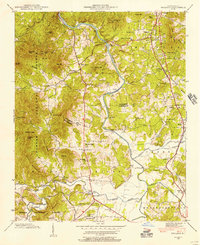
Editions of this 1942 Skyland Map
2 editions found
Other maps of this area

1894 · Asheville
USGS Topo · 1:125,000

1900 · Mount Mitchell
USGS Topo · 1:125,000

1901 · Asheville
USGS Topo · 1:125,000

1902 · Mount Mitchell
USGS Topo · 1:125,000

1905 · Pisgah
USGS Topo · 1:125,000

1906 · Pisgah
USGS Topo · 1:125,000

1907 · Saluda
USGS Topo · 1:125,000

1935 · Horse Shoe
USGS Topo · 1:24,000

1935 · Hendersonville
USGS Topo · 1:24,000

1935 · Pisgah Forest
USGS Topo · 1:24,000