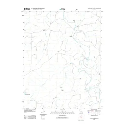
2012 Map of Slabtown Spring
USGS Topo · Published 2012About this map
Hazleton and Slabtown sit along the winding course of the Big Piney River, highlighting the water-dependent settlement patterns of this Missouri landscape. The river creates distinctive features like Pocket Eddy and is fed by significant sources such as Slabtown Spring and Prewett Spring. This 2012 survey illustrates the network of hollows that define the terrain, including Wolf Hollow, Anderson Hollow, and Coffey Hollow. Local history is anchored by the Omalley Cemetery and Merrill Cemetery, while small water bodies like Slabtown Lake and Roby Lake indicate localized damming for recreation or resource management. The map also traces a complex system of forestry and farm roads, including Slabtown Rd and Dogtown Dr, which connect the small clusters of Edanville and Ladd through the Missouri woods.
Find a feature on this map
52 named features on this map. Tap any name to fly to it.
Don’t see what you’re looking for? This feature index may not catch every label — zoom into the map to look around manually.
Map Details
Editions of this 2012 Slabtown Spring Map
This is the sole edition of this map. No revisions or reprints were ever made.
Other maps of this area

1937 · Edgar Springs
USGS Topo · 1:48,000

1941 · Big Piney
USGS Topo · 1:62,500

1941 · Bado
USGS Topo · 1:62,500

1943 · Big Piney
USGS Topo · 1:62,500

1943 · Bado
USGS Topo · 1:62,500

1945 · Edgar Springs
USGS Topo · 1:62,500

1949 · Rolla
USGS Topo · 1:250,000

1951 · Prescott
USGS Topo · 1:24,000

1951 · Raymondville
USGS Topo · 1:62,500

1953 · Rolla
USGS Topo · 1:250,000