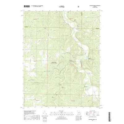
2017 Map of Slabtown Spring
USGS Topo · Published 2017About this map
Slabtown and Hazleton sit within the Ozark landscape of the Mark Twain National Forest, centered on the winding course of the Big Piney River. This 2017 study illustrates a rugged terrain defined by deep hollows like Wolf Hollow and Anderson Hollow, where the land is carved by numerous tributaries including Little Paddy Cr and Bald Ridge Cr. The presence of Slabtown Spring and Prewett Spring highlights the region's complex karst topography, typical of south-central Missouri. Cultural history is preserved at the Merrill Cem and Omalley Cem, while the Paddy Creek-Big Piney Trail winds through the hills, passing the notable Paddy Creek Natural Arch. The map captures a junction where Pulaski, Texas, and Phelps counties meet, showing a network of forest roads and remote river bends like Pocket Eddy.
Find a feature on this map
68 named features on this map. Tap any name to fly to it.
Don’t see what you’re looking for? This feature index may not catch every label — zoom into the map to look around manually.
Map Details
Editions of this 2017 Slabtown Spring Map
This is the sole edition of this map. No revisions or reprints were ever made.
Other maps of this area

1937 · Edgar Springs
USGS Topo · 1:48,000

1941 · Big Piney
USGS Topo · 1:62,500

1941 · Bado
USGS Topo · 1:62,500

1943 · Big Piney
USGS Topo · 1:62,500

1943 · Bado
USGS Topo · 1:62,500

1945 · Edgar Springs
USGS Topo · 1:62,500

1949 · Rolla
USGS Topo · 1:250,000

1951 · Prescott
USGS Topo · 1:24,000

1951 · Raymondville
USGS Topo · 1:62,500

1953 · Rolla
USGS Topo · 1:250,000