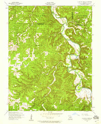
1954 Map of Slabtown Spring
USGS Topo · Published 1959About this map
The Big Piney River carves a deep path through this portion of the Mark Twain National Forest, defining the geography of the borderlands between Texas, Phelps, and Pulaski counties. In the mid-1950s, this landscape was characterized by small, river-dependent settlements and isolated rural institutions. Slabtown and Hazleton sit near the riverbanks, while several country schools like Bell School and Mooney Hollow School served the surrounding hollows.
Find a feature on this map
33 named features on this map. Tap any name to fly to it.
Don’t see what you’re looking for? This feature index may not catch every label — zoom into the map to look around manually.
Map Details
Editions of this 1954 Slabtown Spring Map
3 editions found
Other maps of this area

1937 · Edgar Springs
USGS Topo · 1:48,000

1941 · Big Piney
USGS Topo · 1:62,500

1941 · Bado
USGS Topo · 1:62,500

1943 · Big Piney
USGS Topo · 1:62,500

1943 · Bado
USGS Topo · 1:62,500

1945 · Edgar Springs
USGS Topo · 1:62,500

1949 · Rolla
USGS Topo · 1:250,000

1951 · Prescott
USGS Topo · 1:24,000

1951 · Raymondville
USGS Topo · 1:62,500

1953 · Rolla
USGS Topo · 1:250,000