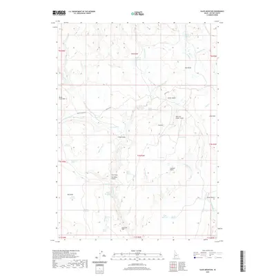
2020 Map of Slack Mountain
USGS Topo · Published 2020About this map
Slack Mountain rises as a central landmark in this high-desert Owyhee County landscape, where water management is the primary evidence of human activity. The terrain is defined by a network of seasonal drainages and numerous small impoundments such as Burkhart Reservoir, Hackberry Reservoir, and Kecks Reservoir. These features, alongside isolated watering points like Frying Pan Spring and Jackass Spring, illustrate the infrastructure required for livestock grazing in this arid environment.
Find a feature on this map
53 named features on this map. Tap any name to fly to it.
Don’t see what you’re looking for? This feature index may not catch every label — zoom into the map to look around manually.
Map Details
Editions of this 2020 Slack Mountain Map
This is the sole edition of this map. No revisions or reprints were ever made.
Other maps of this area

1955 · Jordan Valley
USGS Topo · 1:250,000

1957 · Jordan Valley
USGS Topo · 1:250,000

1958 · Jordan Valley
USGS Topo · 1:250,000
1973 · Wagon Box Basin
USGS Topo · 1:24,000

1973 · Smith Creek
USGS Topo · 1:24,000

1973 · Castro Table
USGS Topo · 1:24,000

1973 · Indian Meadows
USGS Topo · 1:24,000

1973 · Hurry Up Creek
USGS Topo · 1:24,000

1973 · Pleasant Valley
USGS Topo · 1:24,000

1973 · Wickiup Creek
USGS Topo · 1:24,000