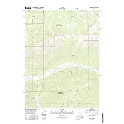
2017 Map of Slader Basin
USGS Topo · Published 2017About this map
The Wasatch National Forest dominates this Summit County landscape, where the Weber River cuts through the high country. In the southern portion of the quadrangle, the Smith and Morehouse Reservoir sits at the confluence of Smith and Morehouse Creek and Bear Trap Creek, serving as a focal point for the surrounding canyons. The terrain is defined by dramatic elevation changes, rising from the river valley to the heights of Humpy Peak and Windy Ridge.
Find a feature on this map
37 named features on this map. Tap any name to fly to it.
Don’t see what you’re looking for? This feature index may not catch every label — zoom into the map to look around manually.
Map Details
Editions of this 2017 Slader Basin Map
This is the sole edition of this map. No revisions or reprints were ever made.
Other maps of this area

1885 · Salt Lake
USGS Topo · 1:250,000

1885 · Uinta
USGS Topo · 1:250,000

1900 · Coalville
USGS Topo · 1:125,000

1901 · Hayden Peak
USGS Topo · 1:125,000

1903 · Hayden Peak
USGS Topo · 1:125,000

1903 · Coalville
USGS Topo · 1:125,000

1954 · Salt Lake City
USGS Topo · 1:250,000

1958 · Salt Lake City
USGS Topo · 1:250,000

1960 · Salt Lake City
USGS Topo · 1:250,000
1967 · Upton
USGS Topo · 1:24,000