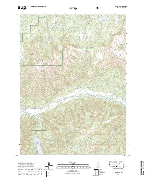
2023 Map of Slader Basin
USGS Topo · Published 2023About this map
Wasatch National Forest dominates this high-elevation landscape in Summit County, where the Weber River carves a central corridor through steep canyon terrain. The map documents the vital water management infrastructure of the region, anchored by the Smith and Morehouse Reservoir in the southwest and a network of drainages including Slader Creek and Moffit Creek. The distribution of backcountry access is highly visible, with the Slader Basin Atv Trl and Holiday Atv Trl tracing the ridges and basins that define the local topography.
Find a feature on this map
32 named features on this map. Tap any name to fly to it.
Don’t see what you’re looking for? This feature index may not catch every label — zoom into the map to look around manually.
Map Details
Editions of this 2023 Slader Basin Map
This is the sole edition of this map. No revisions or reprints were ever made.
Other maps of this area

1885 · Salt Lake
USGS Topo · 1:250,000

1885 · Uinta
USGS Topo · 1:250,000

1900 · Coalville
USGS Topo · 1:125,000

1901 · Hayden Peak
USGS Topo · 1:125,000

1903 · Hayden Peak
USGS Topo · 1:125,000

1903 · Coalville
USGS Topo · 1:125,000

1954 · Salt Lake City
USGS Topo · 1:250,000

1958 · Salt Lake City
USGS Topo · 1:250,000

1960 · Salt Lake City
USGS Topo · 1:250,000
1967 · Upton
USGS Topo · 1:24,000