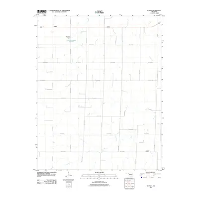
2010 Map of Slapout
USGS Topo · Published 2010About this map
Slapout occupies a high plains position in the Oklahoma Panhandle, defined by a rigid grid of rural roads and the intermittent drainage of the High Plains. This 2010 survey by the U.S. Geological Survey reveals a landscape of massive square sections, where the road network follows strict cardinal directions with identifiers like Hollow N1660 and Hollow E0310. Water management is central to the area's geography, evidenced by the Oknoname 007006 Dam and its associated Oknoname 007006 Reservoir situated just south of the main settlement. The terrain is marked by the winding paths of Clear Creek, Spring Creek, and Camp Creek, which break the geometric precision of the section lines. Local heritage is anchored by the Poplar Grove Cemetery in the southeastern corner, serving as a primary point of interest for those researching family history in this corner of Beaver County.
Find a feature on this map
30 named features on this map. Tap any name to fly to it.
Don’t see what you’re looking for? This feature index may not catch every label — zoom into the map to look around manually.
Map Details
Editions of this 2010 Slapout Map
This is the sole edition of this map. No revisions or reprints were ever made.
Other maps of this area

1954 · Perryton
USGS Topo · 1:250,000

1955 · Woodward
USGS Topo · 1:250,000

1958 · Perryton
USGS Topo · 1:250,000

1958 · Woodward
USGS Topo · 1:250,000

1969 · Shattuck NW
USGS Topo · 1:24,000

1970 · Laverne SW
USGS Topo · 1:24,000

1971 · Logan
USGS Topo · 1:24,000

1971 · Logan NW
USGS Topo · 1:24,000

1971 · Logan NE
USGS Topo · 1:24,000

1971 · Slapout
USGS Topo · 1:24,000