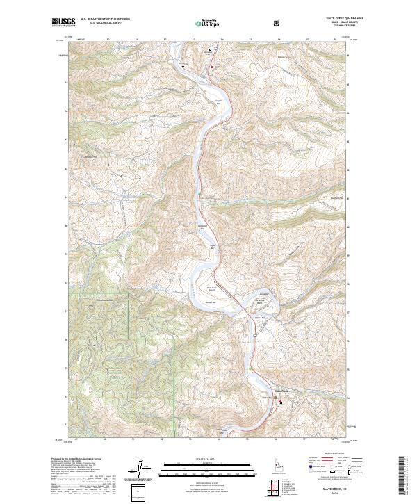
2024 Map of Slate Creek
USGS Topo · Published 2024About this map
The Salmon River carves a deep path through this Idaho landscape, where the settlement of Slate Creek serves as a small hub for the canyon's inhabitants and travelers. The map reveals the critical importance of river access and terraced land, with numerous named bars such as Campbell Flat, Taylor Bar, and Russell Bar providing rare flat ground for settlement and transportation. For genealogists and local historians, several burial sites are documented along the river corridor, including French Cem and the White Bird Cem near the northern boundary.
Find a feature on this map
71 named features on this map. Tap any name to fly to it.
Don’t see what you’re looking for? This feature index may not catch every label — zoom into the map to look around manually.
Map Details
Editions of this 2024 Slate Creek Map
This is the sole edition of this map. No revisions or reprints were ever made.
Other maps of this area

1955 · Grangeville
USGS Topo · 1:250,000

1959 · Grangeville
USGS Topo · 1:250,000

1963 · John Day Mtn
USGS Topo · 1:24,000

1963 · Lucile
USGS Topo · 1:24,000

1963 · McKinzie Creek
USGS Topo · 1:24,000

1963 · White Bird Hill
USGS Topo · 1:24,000

1963 · Slate Creek
USGS Topo · 1:24,000

1963 · Kirkwood Creek
USGS Topo · 1:24,000

1963 · Joseph
USGS Topo · 1:24,000

1963 · Grave Point
USGS Topo · 1:24,000