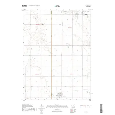
2018 Map of Slater
USGS Topo · Published 2018About this map
Slater anchors the southern portion of this central Iowa landscape, positioned at the intersection of a grid-iron road network and the gentle course of Fourmile Cr. To the north, the small settlements of Kelley and Napier sit among the productive fields of the Boone and Story County borderlands. The terrain is defined by the drainage basins of Walnut Cr and Ballard Cr, which meander through the prairie landscape. Near the northeastern corner, the suburban fringes of Ames begin to emerge, marked by the Ames Municipal Airport and its surrounding residential developments such as Suncrest Dr. Scattered throughout the rural sections are essential community landmarks, including Bethany Cem and Sheldahl Cem, which offer significant value for genealogists tracing local families in the area north of Slater.
Find a feature on this map
61 named features on this map. Tap any name to fly to it.
Don’t see what you’re looking for? This feature index may not catch every label — zoom into the map to look around manually.
Map Details
Editions of this 2018 Slater Map
This is the sole edition of this map. No revisions or reprints were ever made.
Other maps of this area

1911 · Madrid
USGS Topo · 1:62,500

1911 · Slater
USGS Topo · 1:62,500

1912 · Ames
USGS Topo · 1:62,500

1913 · Slater
USGS Topo · 1:62,500

1914 · Madrid
USGS Topo · 1:62,500

1914 · Ames
USGS Topo · 1:62,500

1916 · Boone
USGS Topo · 1:62,500

1954 · Waterloo
USGS Topo · 1:250,000

1954 · Des Moines
USGS Topo · 1:250,000

1955 · Waterloo
USGS Topo · 1:250,000