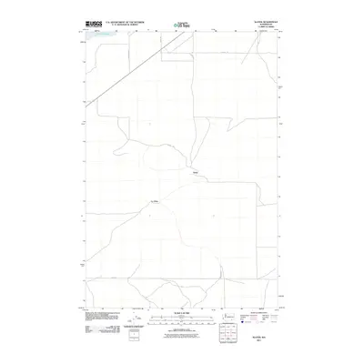
2011 Map of Slater
USGS Topo · Published 2011About this map
Slater and the nearby settlement of Le Grow anchor this landscape in Walla Walla County, where the topography transitions toward the shores of Lake Sacajawea. The map reveals a highly structured grid of rural infrastructure, defined by long straightaways such as Dodd Rd and Adkins Rd that underscore the region's agricultural layout. These roads, including Slater Rd and Agate Rd, provide the primary framework for the area's development. The presence of Sun Harbor Dr near the water's edge suggests localized residential growth or access points tied to the reservoir's northern reaches. This 2011 survey by the U.S. Geological Survey documents the persistent rural character and established transport lines of the region at the start of the second decade of the 21st century.
Find a feature on this map
9 named features on this map. Tap any name to fly to it.
Don’t see what you’re looking for? This feature index may not catch every label — zoom into the map to look around manually.
Map Details
Editions of this 2011 Slater Map
This is the sole edition of this map. No revisions or reprints were ever made.
Other maps of this area

1915 · Wallulah
USGS Topo · 1:96,000

1918 · Wallula
USGS Topo · 1:125,000

1953 · Walla Walla
USGS Topo · 1:250,000

1958 · Walla Walla
USGS Topo · 1:250,000

1964 · Wallula
USGS Topo · 1:24,000

1964 · Zangar Junction
USGS Topo · 1:24,000

1964 · Levey SW
USGS Topo · 1:24,000

1964 · Levey SE
USGS Topo · 1:24,000

1964 · Slater
USGS Topo · 1:24,000

1964 · Humorist
USGS Topo · 1:24,000