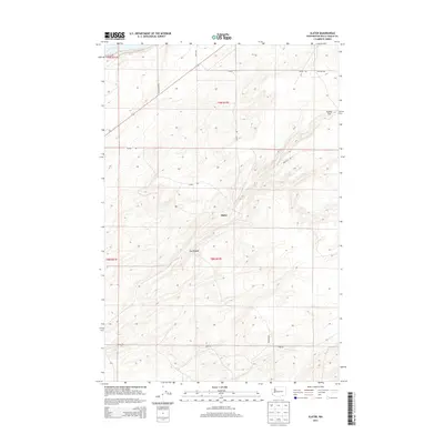
2013 Map of Slater
USGS Topo · Published 2013About this map
Slater and Le Grow anchor this landscape in Walla Walla County, where rural development is defined by a sparse grid of country roads. The topography is dominated by the broad expanse of Eureka Flat, a characteristic feature of this inland region. The road network, including Shoreline Rd and Agate Rd, suggests a pattern of land use that prioritizes agricultural access across the undulating terrain. Small, named locales like Le Grow serve as focal points for the surrounding township divisions. This survey captures the area as it transitioned through the early 21st century, maintaining its character as a quiet, open expanse of the Pacific Northwest. The detailed contours reveal the subtle elevation changes that define the drainage and movement across this portion of the county.
Find a feature on this map
15 named features on this map. Tap any name to fly to it.
Don’t see what you’re looking for? This feature index may not catch every label — zoom into the map to look around manually.
Map Details
Editions of this 2013 Slater Map
This is the sole edition of this map. No revisions or reprints were ever made.
Other maps of this area

1915 · Wallulah
USGS Topo · 1:96,000

1918 · Wallula
USGS Topo · 1:125,000

1953 · Walla Walla
USGS Topo · 1:250,000

1958 · Walla Walla
USGS Topo · 1:250,000

1964 · Wallula
USGS Topo · 1:24,000

1964 · Zangar Junction
USGS Topo · 1:24,000

1964 · Levey SW
USGS Topo · 1:24,000

1964 · Levey SE
USGS Topo · 1:24,000

1964 · Slater
USGS Topo · 1:24,000

1964 · Humorist
USGS Topo · 1:24,000