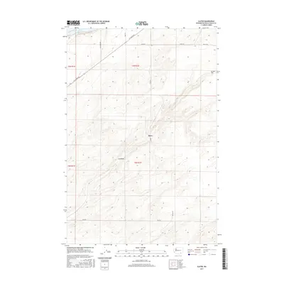
2017 Map of Slater
USGS Topo · Published 2017About this map
Lake Sacajawea and the winding course of the Snake River dominate the northwestern corner of this Walla Walla County survey. The landscape transitions from the river valley into the high, contoured terrain of Eureka Flat, an area defined by its agricultural and transport patterns. Small rural nodes like Slater and Le Grow are positioned along a grid of local roads, including Slater Rd and Adkins Rd, reflecting the enduring surveyor-style layout of the region's wheat country. The topography is marked by significant elevation changes, with numerous coulees and ridges carved into the plateau above the river. Notable infrastructure like Ice Harbor Dr connects the interior tablelands to the vital waterway, illustrating the spatial relationship between these upland agricultural plains and the river-based logistics of the Pacific Northwest.
Find a feature on this map
17 named features on this map. Tap any name to fly to it.
Don’t see what you’re looking for? This feature index may not catch every label — zoom into the map to look around manually.
Map Details
Editions of this 2017 Slater Map
This is the sole edition of this map. No revisions or reprints were ever made.
Other maps of this area

1915 · Wallulah
USGS Topo · 1:96,000

1918 · Wallula
USGS Topo · 1:125,000

1953 · Walla Walla
USGS Topo · 1:250,000

1958 · Walla Walla
USGS Topo · 1:250,000

1964 · Wallula
USGS Topo · 1:24,000

1964 · Zangar Junction
USGS Topo · 1:24,000

1964 · Levey SW
USGS Topo · 1:24,000

1964 · Levey SE
USGS Topo · 1:24,000

1964 · Slater
USGS Topo · 1:24,000

1964 · Humorist
USGS Topo · 1:24,000