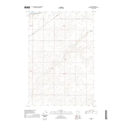
2020 Map of Slater
USGS Topo · Published 2020About this map
The Snake River carves through the northwestern corner of this territory, where its waters form Lake Sacajawea behind the downstream dam system. This Walla Walla County landscape is defined by the broad, high-elevation expanse of Eureka Flat and a network of rural roads that follow the section lines of the Public Land Survey System. The small settlements of Slater and Le Grow sit within this agricultural and arid terrain, connected by thoroughfares such as Ice Harbor Dr and Agate Rd. The topography is marked by numerous draws and coulees, typical of the regional geography shaped by the river's drainage patterns. This modern survey reflects the enduring rural character of the area, where large-scale farming and water management are the primary drivers of the local economy and land use.
Find a feature on this map
16 named features on this map. Tap any name to fly to it.
Don’t see what you’re looking for? This feature index may not catch every label — zoom into the map to look around manually.
Map Details
Editions of this 2020 Slater Map
This is the sole edition of this map. No revisions or reprints were ever made.
Other maps of this area

1915 · Wallulah
USGS Topo · 1:96,000

1918 · Wallula
USGS Topo · 1:125,000

1953 · Walla Walla
USGS Topo · 1:250,000

1958 · Walla Walla
USGS Topo · 1:250,000

1964 · Wallula
USGS Topo · 1:24,000

1964 · Zangar Junction
USGS Topo · 1:24,000

1964 · Levey SW
USGS Topo · 1:24,000

1964 · Levey SE
USGS Topo · 1:24,000

1964 · Slater
USGS Topo · 1:24,000

1964 · Humorist
USGS Topo · 1:24,000