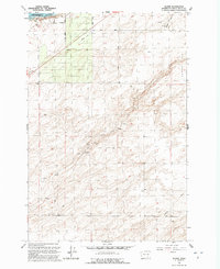
1991 Map of Slater
USGS Topo · Published 1992About this map
The Snake River corridor in Walla Walla County defines this landscape, where the waters of Lake Sacajawea meet the agricultural expanse of Eureka Flat. This early 1990s record of the region shows a transition between the river-focused infrastructure and the surrounding upland farms. Industrial and logistical markers such as a Landing Strip, several Gravel Pits, and a Grain Bin reflect a rural economy built on transport and resource extraction.
Find a feature on this map
22 named features on this map. Tap any name to fly to it.
Don’t see what you’re looking for? This feature index may not catch every label — zoom into the map to look around manually.
Map Details
Editions of this 1991 Slater Map
This is the sole edition of this map. No revisions or reprints were ever made.
Other maps of this area

1915 · Wallulah
USGS Topo · 1:96,000

1918 · Wallula
USGS Topo · 1:125,000

1953 · Walla Walla
USGS Topo · 1:250,000

1958 · Walla Walla
USGS Topo · 1:250,000

1964 · Wallula
USGS Topo · 1:24,000

1964 · Zangar Junction
USGS Topo · 1:24,000

1964 · Levey SW
USGS Topo · 1:24,000

1964 · Levey SE
USGS Topo · 1:24,000

1964 · Slater
USGS Topo · 1:24,000

1964 · Humorist
USGS Topo · 1:24,000