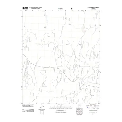
2011 Map of Slaughter Mesa
USGS Topo · Published 2011About this map
Slaughter Mesa dominates the central landscape of this western New Mexico territory, characterized by a complex network of canyons and high-elevation terrain. This 2011 survey documents a remote portion of the Mangas Mountains where drainage systems like Largo Canyon and Dead Horse Canyon define the watershed around Largo Creek. The topography is marked by significant vertical relief, providing an overview of land management and forestry infrastructure as it stood in the early 21st century.
Find a feature on this map
10 named features on this map. Tap any name to fly to it.
Don’t see what you’re looking for? This feature index may not catch every label — zoom into the map to look around manually.
Map Details
Editions of this 2011 Slaughter Mesa Map
This is the sole edition of this map. No revisions or reprints were ever made.
Other maps of this area

1915 · Reserve
USGS Topo · 1:125,000

1918 · Pelona
USGS Topo · 1:125,000

1918 · Reserve
USGS Topo · 1:125,000

1954 · Clifton
USGS Topo · 1:250,000

1954 · Saint Johns
USGS Topo · 1:250,000

1957 · Clifton
USGS Topo · 1:250,000

1957 · Saint Johns
USGS Topo · 1:250,000

1958 · Clifton
USGS Topo · 1:250,000

1958 · Saint Johns
USGS Topo · 1:250,000

1962 · Clifton
USGS Topo · 1:250,000