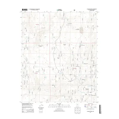
2013 Map of Slaughter Mesa
USGS Topo · Published 2013About this map
The Apache National Forest dominates this high-altitude terrain in Catron County, where the Continental Divide winds through the southern reaches of the Slaughter Mesa quadrangle. The landscape is a network of deep drainage systems, most notably Largo Canyon and Salvador Canyon, which define the water movement across the mesa. At the western edge, El Caso Lookout stands as a sentinel over El Caso Lake and the surrounding timberland. This area is characterized by its vital water sources in an arid environment, represented by a dense concentration of named springs and tanks. Remote outposts and stock water points like Lyles Camp Spring, Cooper Seep Spring, and Gooseberry Pit are scattered throughout the forest, connected by primitive routes such as State Rte 93 and FS RD 13. The geography illustrates the reliance on these isolated watering holes for forestry and ranching operations near the Mangas Mountains.
Find a feature on this map
55 named features on this map. Tap any name to fly to it.
Don’t see what you’re looking for? This feature index may not catch every label — zoom into the map to look around manually.
Map Details
Editions of this 2013 Slaughter Mesa Map
This is the sole edition of this map. No revisions or reprints were ever made.
Other maps of this area

1915 · Reserve
USGS Topo · 1:125,000

1918 · Pelona
USGS Topo · 1:125,000

1918 · Reserve
USGS Topo · 1:125,000

1954 · Clifton
USGS Topo · 1:250,000

1954 · Saint Johns
USGS Topo · 1:250,000

1957 · Clifton
USGS Topo · 1:250,000

1957 · Saint Johns
USGS Topo · 1:250,000

1958 · Clifton
USGS Topo · 1:250,000

1958 · Saint Johns
USGS Topo · 1:250,000

1962 · Clifton
USGS Topo · 1:250,000