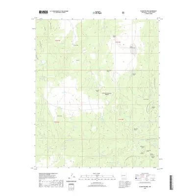
2020 Map of Slaughter Mesa
USGS Topo · Published 2020About this map
The Continental Divide winds through the high-elevation landscape of Catron County, defining a territory within the Apache National Forest where water management is the primary sign of human activity. This 2020 map documents a sophisticated network of catchments and natural sources, ranging from El Caso Lake and Largo Canyon Tank to family-named points like Leslie Spring and McKibben Tank. The drainage patterns are dominated by Largo Canyon, which is paralleled by the Largo Canyon Trail, while the southeastern corner is anchored by the rising slopes of the Mangas Mountains. Sparse industrial features like Gooseberry Pit and Lake Pit suggest localized resource extraction in an otherwise wilderness-oriented area. The presence of the Continental Divide National Scenic Trail underscores the region's importance for long-distance navigation and conservation within the Gila wilderness complex.
Find a feature on this map
50 named features on this map. Tap any name to fly to it.
Don’t see what you’re looking for? This feature index may not catch every label — zoom into the map to look around manually.
Map Details
Editions of this 2020 Slaughter Mesa Map
This is the sole edition of this map. No revisions or reprints were ever made.
Other maps of this area

1915 · Reserve
USGS Topo · 1:125,000

1918 · Pelona
USGS Topo · 1:125,000

1918 · Reserve
USGS Topo · 1:125,000

1954 · Clifton
USGS Topo · 1:250,000

1954 · Saint Johns
USGS Topo · 1:250,000

1957 · Clifton
USGS Topo · 1:250,000

1957 · Saint Johns
USGS Topo · 1:250,000

1958 · Clifton
USGS Topo · 1:250,000

1958 · Saint Johns
USGS Topo · 1:250,000

1962 · Clifton
USGS Topo · 1:250,000