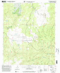
1999 Map of Slaughter Mesa
USGS Topo · Published 2002About this map
The Continental Divide winds through the high country of Catron County in this 1999 revision of the Apache National Forest. This high-altitude landscape is defined by the Mangas Mountains and the broad elevation of Slaughter Mesa, a region where water management is critical for land use. The map reveals an intricate network of livestock and wildlife support, featuring numerous named tanks and pits such as Jacobs Camp Tank, Antelope Tank, and the Gooseberry Pit. The drainage patterns are clear, with Largo Creek and Antone Creek cutting through a series of canyons including Largo Canyon and Salvador Canyon. Human activity is marked by scattered infrastructure like the Cinder Pit and a web of 4wd tracks and forest roads that provide access to remote springs like Lotus Camp Spring and El Caso Spring.
Find a feature on this map
56 named features on this map. Tap any name to fly to it.
Don’t see what you’re looking for? This feature index may not catch every label — zoom into the map to look around manually.
Map Details
Editions of this 1999 Slaughter Mesa Map
This is the sole edition of this map. No revisions or reprints were ever made.
Other maps of this area

1915 · Reserve
USGS Topo · 1:125,000

1918 · Pelona
USGS Topo · 1:125,000

1918 · Reserve
USGS Topo · 1:125,000

1954 · Clifton
USGS Topo · 1:250,000

1954 · Saint Johns
USGS Topo · 1:250,000

1957 · Clifton
USGS Topo · 1:250,000

1957 · Saint Johns
USGS Topo · 1:250,000

1958 · Clifton
USGS Topo · 1:250,000

1958 · Saint Johns
USGS Topo · 1:250,000

1962 · Clifton
USGS Topo · 1:250,000