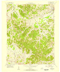
1954 Map of Slaughters
USGS Topo · Published 1955About this map
The Louisville and Nashville railroad corridor anchors the community of Slaughters, where the tracks parallel the eastern edge of the Shake Rag Hills. This mid-century survey reveals a landscape of ridge-top settlements and winding valley roads, with the Webster Co Hopkins Co boundary cutting diagonally across the terrain. While the town of Slaughters sits as the primary hub, smaller points of interest like Veazey and a Strip Mine (Inactive) hint at the local transition from agriculture to mineral extraction.
Find a feature on this map
39 named features on this map. Tap any name to fly to it.
Don’t see what you’re looking for? This feature index may not catch every label — zoom into the map to look around manually.
Map Details
Editions of this 1954 Slaughters Map
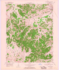
2 editions found
Other maps of this area

1906 · Sebree
USGS Topo · 1:62,500

1907 · Earlington
USGS Topo · 1:48,000

1908 · Calhoun
USGS Topo · 1:62,500

1909 · Earlington
USGS Topo · 1:62,500

1909 · Madisonville
USGS Topo · 1:62,500

1949 · Sebree
USGS Topo · 1:24,000

1951 · Dixon
USGS Topo · 1:24,000

1951 · Sebree
USGS Topo · 1:24,000

1952 · Beech Grove
USGS Topo · 1:24,000

1952 · Hanson
USGS Topo · 1:24,000