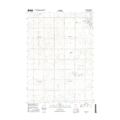
2016 Map of Slayton
USGS Topo · Published 2016About this map
The Coteau des Prairies upland plateau dominates this portion of Murray County, where the agricultural landscape is punctuated by glacial lakes and small prairie settlements. The town of Slayton serves as a local hub, shown with its residential street grid including Broadway Ave and Oak Ave, situated just north of the Slayton Municipal Airport. To the west, the village of Hadley sits near the shores of Summit Lake, while Iona occupies the southeastern corner of the quadrangle. Genealogists will find the locations of Saint Columba Cem and Zion Lutheran Church Cem clearly marked near the Iona settlement. The hydrology of the area is defined by intermittent streams and small basins, including the headwaters of Chanarambie Cr and the waters of Corabelle Lake at the southern edge, illustrating the complex drainage patterns of the Minnesota prairie.
Find a feature on this map
56 named features on this map. Tap any name to fly to it.
Don’t see what you’re looking for? This feature index may not catch every label — zoom into the map to look around manually.
Map Details
Editions of this 2016 Slayton Map
This is the sole edition of this map. No revisions or reprints were ever made.
Other maps of this area

1953 · New Ulm
USGS Topo · 1:250,000

1954 · Fairmont
USGS Topo · 1:250,000

1957 · New Ulm
USGS Topo · 1:250,000

1958 · New Ulm
USGS Topo · 1:250,000

1958 · Fairmont
USGS Topo · 1:250,000

1967 · New Ulm
USGS Topo · 1:250,000

1967 · Slayton SW
USGS Topo · 1:24,000

1967 · Slayton
USGS Topo · 1:24,000
1967 · Balaton SW
USGS Topo · 1:24,000

1967 · Wilmont
USGS Topo · 1:24,000