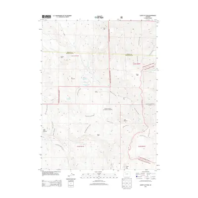
2013 Map of Sleepy Cat Peak
USGS Topo · Published 2013About this map
White River National Forest and Routt National Forest converge in this high-elevation landscape, where cattle ranching and water management define the land use. The presence of the Morapos Cow Camp near the Morapos Trailhead highlights the area's continued role in mountain grazing. Water is carefully directed through the high country via the Carrigan Averill Ditch and Owen Carrigan Ditch, feeding several high-altitude catchments including Cove Lake Reservoir and Konopik Reservoir. Prominent peaks like Iles Mountain, Baldy Mountain, and the namesake Sleepy Cat Peak anchor the topography, while Horse Ridge separates the northern drainages from the Milk Cr valley to the south. An extensive network of named trails, such as the Milk Creekhorse Ridge Trail 1807, provides access across the timberline and through the gulches.
Find a feature on this map
45 named features on this map. Tap any name to fly to it.
Don’t see what you’re looking for? This feature index may not catch every label — zoom into the map to look around manually.
Map Details
Editions of this 2013 Sleepy Cat Peak Map
This is the sole edition of this map. No revisions or reprints were ever made.
Other maps of this area

1910 · Danforth Hills
USGS Topo · 1:125,000

1915 · Monument Butte
USGS Topo · 1:62,500

1916 · Daton Peak
USGS Topo · 1:62,500

1920 · Daton Peak
USGS Topo · 1:62,500

1954 · Craig
USGS Topo · 1:250,000

1957 · Craig
USGS Topo · 1:250,000

1958 · Craig
USGS Topo · 1:250,000

1960 · Craig
USGS Topo · 1:250,000

1962 · Craig
USGS Topo · 1:250,000

1964 · Craig
USGS Topo · 1:250,000