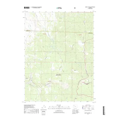
2019 Map of Sleepy Cat Peak
USGS Topo · Published 2019About this map
White River National Forest and Routt National Forest meet in this high-altitude landscape along the Moffat and Rio Blanco County line. The map reveals a complex network of water management features, including the Owen-Carrigan Reservoir, Cove Lake Reservoir, and the Owen-Carrigan Ditch, which redirect snowmelt across the divide. Dominating the topography is the massive Sleepy Cat Peak and the high expanse of Wilson Mesa. Historical transit routes like the Konopic Cutoff and Winslet Cutoff suggest long-established patterns of travel through these mountains. Remote peaks such as Baldy Mtn and Three Points Mtn provide significant vertical relief, while names like Shell Rock and Horse Ridge reflect the descriptive language of early surveyors and ranchmen who first named these landmarks.
Find a feature on this map
44 named features on this map. Tap any name to fly to it.
Don’t see what you’re looking for? This feature index may not catch every label — zoom into the map to look around manually.
Map Details
Editions of this 2019 Sleepy Cat Peak Map
This is the sole edition of this map. No revisions or reprints were ever made.
Other maps of this area

1910 · Danforth Hills
USGS Topo · 1:125,000

1915 · Monument Butte
USGS Topo · 1:62,500

1916 · Daton Peak
USGS Topo · 1:62,500

1920 · Daton Peak
USGS Topo · 1:62,500

1954 · Craig
USGS Topo · 1:250,000

1957 · Craig
USGS Topo · 1:250,000

1958 · Craig
USGS Topo · 1:250,000

1960 · Craig
USGS Topo · 1:250,000

1962 · Craig
USGS Topo · 1:250,000

1964 · Craig
USGS Topo · 1:250,000