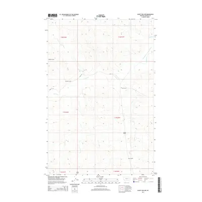
2014 Map of Sleepy Hollow
USGS Topo · Published 2014About this map
Sleepy Hollow sits within a landscape defined by the intricate drainage systems of Garfield County, where the High Plains are carved by winding seasonal watercourses. This area of eastern Montana relies on managed water resources, evidenced by the Little Dry Water Users Association Canal which diverts flow from Little Dry Cr. The terrain is marked by deep draws and geographic depressions known locally as coulees, including the prominent Witchie Coulee and Saurs Coulee. These features, along with Antelope Cr and Hawks Nest Cr, dictate the movement across the land, with Jerrel Rd and Crow Rock Rd serving as the primary connectors through this rural territory. The township and range boundaries of t15n r43e and t16n r43e provide a framework for the vast rangeland that has long supported the region's agricultural and ranching legacy.
Find a feature on this map
16 named features on this map. Tap any name to fly to it.
Don’t see what you’re looking for? This feature index may not catch every label — zoom into the map to look around manually.
Map Details
Editions of this 2014 Sleepy Hollow Map
This is the sole edition of this map. No revisions or reprints were ever made.
Other maps of this area

1954 · Jordan
USGS Topo · 1:250,000

1954 · Forsyth
USGS Topo · 1:250,000

1956 · Jordan
USGS Topo · 1:250,000

1957 · Forsyth
USGS Topo · 1:250,000

1958 · Jordan
USGS Topo · 1:250,000

1958 · Forsyth
USGS Topo · 1:250,000

1964 · Jordan
USGS Topo · 1:250,000

1965 · Little Chalk Butte
USGS Topo · 1:24,000

1965 · Whiteside Ranch
USGS Topo · 1:24,000

1965 · Calamity Coulee
USGS Topo · 1:24,000