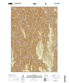
2020 Map of Sleepy Ridge
USGS Topo · Published 2020About this map
Wallowa National Forest land defines this corner of Oregon, where sharp drainage systems and high ridges create a complex vertical landscape. The terrain is marked by colorfully named landmarks like Windy Hell Canyon and Rheumatiz Gulch, suggesting the difficulties encountered by early travelers and surveyors in these steep draws. Water sources are frequent but localized, including Teepee Springs and the headwaters of Lightning Creek and Horse Creek.
Find a feature on this map
59 named features on this map. Tap any name to fly to it.
Don’t see what you’re looking for? This feature index may not catch every label — zoom into the map to look around manually.
Map Details
Editions of this 2020 Sleepy Ridge Map
This is the sole edition of this map. No revisions or reprints were ever made.
Other maps of this area

1922 · He Devil
USGS Topo · 1:48,000

1954 · Imnaha
USGS Topo · 1:62,500

1954 · Kernan Point
USGS Topo · 1:62,500

1954 · Harl Butte
USGS Topo · 1:62,500

1955 · Grangeville
USGS Topo · 1:250,000

1957 · He Devil
USGS Topo · 1:62,500

1959 · Grangeville
USGS Topo · 1:250,000

1980 · Grangeville
USGS Topo · 1:100,000

1987 · Riggins
USGS Topo · 1:100,000

1990 · Imnaha
USGS Topo · 1:24,000