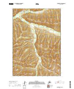
2019 Map of Sleetmute D-4 NW
USGS Topo · Published 2019About this map
Kuskokwim Mountains terrain dominates this portion of the interior, where the drainage systems of the George River basin carve through the landscape. This 2019 survey captures a complex network of wetlands and seasonal hydrology, most notably the winding paths of the East Fork George River and the S Fork George River. The map area is defined by its lack of established roads or permanent settlements, reflecting the wilderness character of the Bethel Census Area. The topography reveals the intricate relationship between the elevated peaks of the Kuskokwim range and the low-lying river valleys that dictate the flow of water through this subarctic environment.
Find a feature on this map
7 named features on this map. Tap any name to fly to it.
Don’t see what you’re looking for? This feature index may not catch every label — zoom into the map to look around manually.
Map Details
Editions of this 2019 Sleetmute D-4 NW Map
This is the sole edition of this map. No revisions or reprints were ever made.
Other maps of this area

1950 · Sleetmute
USGS Topo · 1:250,000

1951 · Iditarod
USGS Topo · 1:250,000

1954 · Sleetmute D-5
USGS Topo · 1:63,360

1954 · Sleetmute D-4
USGS Topo · 1:63,360

1954 · Iditarod A-4
USGS Topo · 1:63,360

1954 · Iditarod A-3
USGS Topo · 1:63,360

1954 · Sleetmute
USGS Topo · 1:250,000

1956 · Iditarod
USGS Topo · 1:250,000
2019 · Sleetmute D-4 SW
USGS Topo · 1:25,000
2019 · Iditarod A-3 SW
USGS Topo · 1:25,000