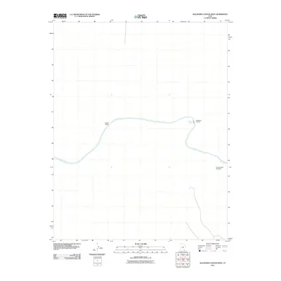
2011 Map of Slickhorn Canyon West
USGS Topo · Published 2011About this map
The San Juan River carves a deep, serpentine path through this corner of San Juan County, defining the geographical character of the landscape. This 2011 survey illustrates the river as it winds through a series of significant canyons and navigational hazards, including the Slickhorn Rapids and Government Rapids to the east. These features, along with the prominent Government Bird Rock, have long served as critical waypoints for river travelers navigating the silt-laden waters of the Colorado Plateau. The convergence of major drainage systems is evident where Grand Gulch meets the main river channel, while the deeply incised Slickhorn Canyon cuts through the high desert terrain. This map serves as a detailed record of the river's course and the named topographical features that have guided explorers and boaters through this remote corridor for generations.
Find a feature on this map
6 named features on this map. Tap any name to fly to it.
Don’t see what you’re looking for? This feature index may not catch every label — zoom into the map to look around manually.
Map Details
Editions of this 2011 Slickhorn Canyon West Map
This is the sole edition of this map. No revisions or reprints were ever made.
Other maps of this area

1886 · Henry Mountains
USGS Topo · 1:250,000

1892 · Henry Mountains
USGS Topo · 1:250,000

1952 · Oljeto
USGS Topo · 1:62,500
1954 · Clay Hills 3 NE
USGS Topo · 1:24,000

1954 · Clay Hills 2 NE
USGS Topo · 1:24,000

1954 · Clay Hills 2 SE
USGS Topo · 1:24,000

1954 · Clay Hills 1 NW
USGS Topo · 1:24,000
1954 · Clay Hills
USGS Topo · 1:62,500

1956 · Escalante
USGS Topo · 1:250,000

1960 · Escalante
USGS Topo · 1:250,000