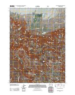
2011 Map of Slide Mountain
USGS Topo · Published 2011About this map
Summer Lake defines the northern edge of this high-desert landscape in Lake County, where geothermal activity and ranching roots intersect. The map illustrates a transition from the lake basin to the volcanic peaks of the Fremont National Forest, featuring the Slide Mountain Lookout Tower atop Slide Mountain. Local land use is centered on water management and recreation, evident in the Withers Dam and the Woodward Reservoir Number One system, which support historic agricultural operations like the J V Withers Ranch. The southern portion of the sheet is dominated by the headwaters of the Sycan River and a network of seasonal creeks including Witham Creek and Bear Creek, providing a detailed look at the hydrology that sustains these upland meadows and forests.
Find a feature on this map
33 named features on this map. Tap any name to fly to it.
Don’t see what you’re looking for? This feature index may not catch every label — zoom into the map to look around manually.
Map Details
Editions of this 2011 Slide Mountain Map
This is the sole edition of this map. No revisions or reprints were ever made.
Other maps of this area

1955 · Klamath Falls
USGS Topo · 1:250,000

1958 · Klamath Falls
USGS Topo · 1:250,000

1966 · Morgan Butte
USGS Topo · 1:24,000

1966 · Slide Mtn
USGS Topo · 1:24,000

1966 · Harvey Creek
USGS Topo · 1:24,000

1966 · Fremont Point
USGS Topo · 1:24,000

1966 · Coffeepot Creek
USGS Topo · 1:24,000

1966 · Paisley
USGS Topo · 1:24,000

1966 · Lee Thomas Crossing
USGS Topo · 1:24,000

1974 · Lake Abert
USGS Topo · 1:100,000