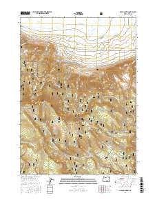
2017 Map of Slide Mountain
USGS Topo · Published 2017About this map
Summer Lake Hot Springs and Gibson Hot Spring mark the low-lying northern basin of this landscape, where the waters of Summer Lake meet the rising foothills of the Fremont National Forest. The map documents a complex hydraulic and transit network within the forest boundaries, featuring the Woodward Reservoir Number One and Woodward Reservoir Number Two. Higher elevations are defined by prominent geological features such as Monument Rock and Slide Mountain, which overlook a series of remote alpine waters including Potts Lake, Blue Lake, and the Slide Lakes. The southern portion of the sheet is bisected by the Sycan River and an extensive system of named trails and forest roads, including the Southern Oregon Intertie Trail and the Hanan-Bear Creek Intertie, illustrating the modern management of these timber and recreational lands.
Find a feature on this map
48 named features on this map. Tap any name to fly to it.
Don’t see what you’re looking for? This feature index may not catch every label — zoom into the map to look around manually.
Map Details
Editions of this 2017 Slide Mountain Map
This is the sole edition of this map. No revisions or reprints were ever made.
Other maps of this area

1955 · Klamath Falls
USGS Topo · 1:250,000

1958 · Klamath Falls
USGS Topo · 1:250,000

1966 · Morgan Butte
USGS Topo · 1:24,000

1966 · Slide Mtn
USGS Topo · 1:24,000

1966 · Harvey Creek
USGS Topo · 1:24,000

1966 · Fremont Point
USGS Topo · 1:24,000

1966 · Coffeepot Creek
USGS Topo · 1:24,000

1966 · Paisley
USGS Topo · 1:24,000

1966 · Lee Thomas Crossing
USGS Topo · 1:24,000

1974 · Lake Abert
USGS Topo · 1:100,000