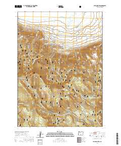
2020 Map of Slide Mountain
USGS Topo · Published 2020About this map
The Fremont National Forest dominates this landscape, defined by a network of specialized routes including the Southern Oregon Intertie Trail and several seasonal snowmobile paths. Notable hydrologic features mark the northern reaches, most specifically the geothermal activity at Gibson Hot Spring and Summer Lake Hot Springs, which sit just south of the vast Summer Lake basin. High elevation landmarks like Monument Rock and Slide Mtn provide the topographical backbone of the quadrangle.
Find a feature on this map
54 named features on this map. Tap any name to fly to it.
Don’t see what you’re looking for? This feature index may not catch every label — zoom into the map to look around manually.
Map Details
Editions of this 2020 Slide Mountain Map
This is the sole edition of this map. No revisions or reprints were ever made.
Other maps of this area

1955 · Klamath Falls
USGS Topo · 1:250,000

1958 · Klamath Falls
USGS Topo · 1:250,000

1966 · Morgan Butte
USGS Topo · 1:24,000

1966 · Slide Mtn
USGS Topo · 1:24,000

1966 · Harvey Creek
USGS Topo · 1:24,000

1966 · Fremont Point
USGS Topo · 1:24,000

1966 · Coffeepot Creek
USGS Topo · 1:24,000

1966 · Paisley
USGS Topo · 1:24,000

1966 · Lee Thomas Crossing
USGS Topo · 1:24,000

1974 · Lake Abert
USGS Topo · 1:100,000